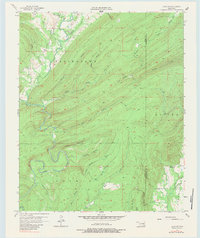
1957 Map of Lane NE
USGS Topo · Published 1983About this map
Impson Valley serves as a central anchor for this 1957 survey of the borderlands between Atoka and Pushmataha Counties. The landscape is defined by a dense network of watercourses and deep hollows, including Happy Hollow and Wildcat Canyon, which descend from the surrounding ridges. Local history is marked by the presence of Impson Ch (Abandoned) and a nearby Cem, indicating a community core that had already shifted by the mid-20th century.
Find a feature on this map
33 named features on this map. Tap any name to fly to it.
Don’t see what you’re looking for? This feature index may not catch every label — zoom into the map to look around manually.
Map Details
Editions of this 1957 Lane NE Map
3 editions found

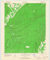
Other maps of this area

1898 · McAlester
USGS Topo · 1:125,000

1901 · Antlers
USGS Topo · 1:125,000

1909 · Mc Alester
USGS Topo · 1:125,000

1912 · Antlers
USGS Topo · 1:125,000

1925 · Antlers
USGS Topo · 1:125,000

1950 · Mcalester
USGS Topo · 1:250,000

1957 · Lane NW
USGS Topo · 1:24,000

1957 · Farris
USGS Topo · 1:24,000

1957 · Moyers
USGS Topo · 1:24,000

1957 · Jumbo
USGS Topo · 1:24,000