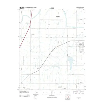
2013 Map of Langston
USGS Topo · Published 2013About this map
The Cimarron River winds through the northern portion of this landscape, framing a region defined by its rural settlements and the energy industry. Langston sits as a central hub in the eastern section, surrounded by numerous historic burial grounds including Beulah Land Cem, Holy Family Cem, and Iowa City Cem. This concentration of cemeteries provides a significant footprint for genealogical research in the area.
Find a feature on this map
64 named features on this map. Tap any name to fly to it.
Don’t see what you’re looking for? This feature index may not catch every label — zoom into the map to look around manually.
Map Details
Editions of this 2013 Langston Map
This is the sole edition of this map. No revisions or reprints were ever made.
Other maps of this area

1892 · Guthrie
USGS Topo · 1:62,500

1893 · Mulhall
USGS Topo · 1:62,500

1893 · Stillwater
USGS Topo · 1:62,500

1909 · Perkins
USGS Topo · 1:62,500

1954 · Oklahoma City
USGS Topo · 1:250,000

1955 · Enid
USGS Topo · 1:250,000

1957 · Oklahoma City
USGS Topo · 1:250,000

1958 · Enid
USGS Topo · 1:250,000

1963 · Oklahoma City
USGS Topo · 1:250,000
1967 · Stillwater SW
USGS Topo · 1:24,000