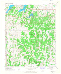
1967 Map of Stillwater SW
USGS Topo · Published 1968About this map
The Indian Meridian runs vertically along the western edge of this 1960s landscape, serving as a primary surveying reference point for the surrounding Oklahoma territory. Central to the local geography is the sprawling Lake Carl Blackwell, with its spillway and the nearby Stillwater Country Club marking the recreational development of the era. The land is defined by a series of drainages, including Wild Horse Creek and Clear Creek, which cut through the Paradise and Cherokee regions.
Find a feature on this map
29 named features on this map. Tap any name to fly to it.
Don’t see what you’re looking for? This feature index may not catch every label — zoom into the map to look around manually.
Map Details
Editions of this 1967 Stillwater SW Map
3 editions found
Other maps of this area

1892 · Guthrie
USGS Topo · 1:62,500

1893 · Mulhall
USGS Topo · 1:62,500

1893 · Stillwater
USGS Topo · 1:62,500

1909 · Perkins
USGS Topo · 1:62,500

1954 · Oklahoma City
USGS Topo · 1:250,000

1955 · Enid
USGS Topo · 1:250,000

1957 · Oklahoma City
USGS Topo · 1:250,000

1958 · Enid
USGS Topo · 1:250,000

1963 · Oklahoma City
USGS Topo · 1:250,000

1966 · Lake Carl Blackwell
USGS Topo · 1:24,000