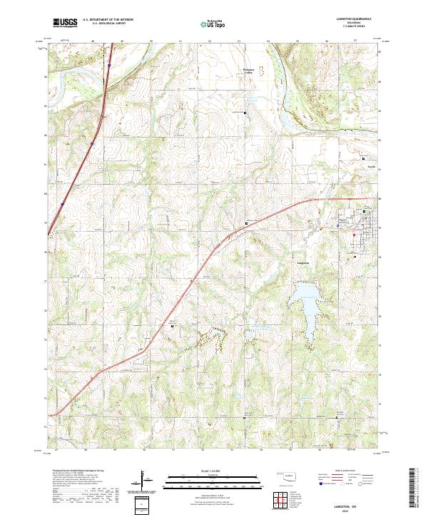
2022 Map of Langston
USGS Topo · Published 2022About this map
Langston University anchors the northeastern portion of this Logan County landscape, situated just north of the town of Langston. The area is characterized by a high concentration of community landmarks, particularly small burial grounds that speak to the local genealogy of the region, including Beulah Land Cem, Holy Family Cem, and Mount Hope Cem. The terrain is defined by the winding course of the Cimarron River in the north and the expansive Lake Langston further south, which is surrounded by several smaller catchments like the Fitzgerald Soldier Cr Site 2 Reservoir. A dense grid of section line roads, such as Henney Rd and Choctaw Rd, organizes the rural space between the established settlements of Coyle and Pleasant Valley, while the Antelope Cr drainage system provides the primary natural relief across the central townships.
Find a feature on this map
70 named features on this map. Tap any name to fly to it.
Don’t see what you’re looking for? This feature index may not catch every label — zoom into the map to look around manually.
Map Details
Editions of this 2022 Langston Map
This is the sole edition of this map. No revisions or reprints were ever made.
Other maps of this area

1892 · Guthrie
USGS Topo · 1:62,500

1893 · Mulhall
USGS Topo · 1:62,500

1893 · Stillwater
USGS Topo · 1:62,500

1909 · Perkins
USGS Topo · 1:62,500

1954 · Oklahoma City
USGS Topo · 1:250,000

1955 · Enid
USGS Topo · 1:250,000

1957 · Oklahoma City
USGS Topo · 1:250,000

1958 · Enid
USGS Topo · 1:250,000

1963 · Oklahoma City
USGS Topo · 1:250,000
1967 · Stillwater SW
USGS Topo · 1:24,000