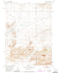
1951 Map of Lankin Dome
USGS Topo · Published 1985About this map
Lankin Dome rises as a prominent landmark in this high-altitude landscape where the Fremont Co Natrona Co line divides the terrain. The map details a cattle-country economy centered on isolated outposts such as Murphy Ranch, supported by a network of essential water sources including Lankin Spring, Sage Hen Creek, and several Windmills. These features illustrate the practical challenges of ranching in an arid environment where water infrastructure was the key to settlement.
Find a feature on this map
21 named features on this map. Tap any name to fly to it.
Don’t see what you’re looking for? This feature index may not catch every label — zoom into the map to look around manually.
Map Details
Editions of this 1951 Lankin Dome Map
3 editions found
Other maps of this area

1951 · Bucklin Reservoirs
USGS Topo · 1:24,000

1951 · Lone Mountain
USGS Topo · 1:24,000

1951 · Black Rock Gap
USGS Topo · 1:24,000

1951 · Split Rock
USGS Topo · 1:24,000

1951 · Split Rock NW
USGS Topo · 1:24,000

1951 · Lankin Dome
USGS Topo · 1:24,000

1952 · Coyote Springs
USGS Topo · 1:24,000

1952 · Mc Intosh Meadows
USGS Topo · 1:24,000

1955 · Casper
USGS Topo · 1:250,000

1958 · Casper
USGS Topo · 1:250,000