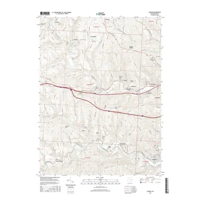
2016 Map of Lansing
USGS Topo · Published 2016About this map
Wheeling Creek and McMahon Creek carve distinct valleys through this portion of Belmont County, shaping the settlement patterns of towns like Blaine, Lansing, and Bellaire. The map reveals a high density of rural burial grounds, including the Hardesty Cem and Linwood Cem, which serve as vital landmarks for genealogical research in these hill communities. The industrial and transit history of the region is evident in the path of the Wheeling & Lake Erie RR and the network of township roads like Hells Kitchen Rd and Mount Pleasant Pike. Distinctive local topography is highlighted by named landforms such as Methodist Ridge and the unusually named Dandelion Hollow, illustrating how the deeply dissected plateau dictated the placement of homes and transport routes along narrow ridge lines and valley floors.
Find a feature on this map
153 named features on this map. Tap any name to fly to it.
Don’t see what you’re looking for? This feature index may not catch every label — zoom into the map to look around manually.
Map Details
Editions of this 2016 Lansing Map
This is the sole edition of this map. No revisions or reprints were ever made.
Other maps of this area

1902 · Wheeling
USGS Topo · 1:62,500

1904 · Cameron
USGS Topo · 1:62,500

1905 · Clarington
USGS Topo · 1:62,500

1905 · St. Clairsville
USGS Topo · 1:62,500

1935 · Cameron
USGS Topo · 1:62,500

1935 · Clarington
USGS Topo · 1:62,500

1935 · Wheeling
USGS Topo · 1:62,500

1940 · Clarington
USGS Topo · 1:62,500

1942 · Cameron
USGS Topo · 1:62,500

1942 · Wheeling
USGS Topo · 1:62,500