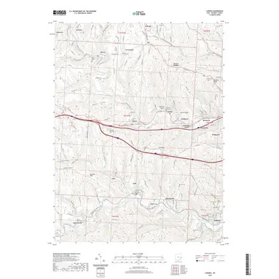
2019 Map of Lansing
USGS Topo · Published 2019About this map
Wheeling Creek and McMahon Creek define the deeply etched topography of this eastern Ohio landscape, where residential corridors follow the winding valley floors between high, level summits. The map illustrates a dense network of early settlements and hollows, including Mutton Hollow, Soaptown Hollow, and Dandelion Hollow, which reflect the localized industrial and social history of the region. Genealogists will find an exceptional density of burial sites, ranging from the High Ridge Cem on the heights to the concentrated grouping of the German Cem, Mount Calvary Cem, and Greenwood Cem near Bellaire. The transition from the established community of Barton in the north to the industrial-residential clusters of Neffs and Saint Joe in the south highlights a landscape shaped by coal and manufacturing. Transport routes like the National Rd and Mount Pleasant Pike reveal how historical thoroughfares continue to dictate the placement of communities such as Blaine and Lansing along the creek bluffs.
Find a feature on this map
144 named features on this map. Tap any name to fly to it.
Don’t see what you’re looking for? This feature index may not catch every label — zoom into the map to look around manually.
Map Details
Editions of this 2019 Lansing Map
This is the sole edition of this map. No revisions or reprints were ever made.
Other maps of this area

1902 · Wheeling
USGS Topo · 1:62,500

1904 · Cameron
USGS Topo · 1:62,500

1905 · Clarington
USGS Topo · 1:62,500

1905 · St. Clairsville
USGS Topo · 1:62,500

1935 · Cameron
USGS Topo · 1:62,500

1935 · Clarington
USGS Topo · 1:62,500

1935 · Wheeling
USGS Topo · 1:62,500

1940 · Clarington
USGS Topo · 1:62,500

1942 · Cameron
USGS Topo · 1:62,500

1942 · Wheeling
USGS Topo · 1:62,500