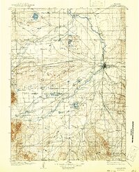
1908 Map of Laramie
USGS Topo · Published 1941About this map
The Laramie River anchors this 1908 topographic perspective of Albany County, where the growing hub of Laramie sits at the junction of the Union Pacific River railroad and the Laramie Upper Main Line. This region is defined by its extensive ranching network, featuring family-named sites such as Alsop's Ranch, Mandel, and Haley's Ranch scattered across the high plains. The map reveals a landscape managed for early industry and resource extraction, notably the Union Pacific Soda Lakes and the Pioneer Ditch irrigation works.
Find a feature on this map
84 named features on this map. Tap any name to fly to it.
Don’t see what you’re looking for? This feature index may not catch every label — zoom into the map to look around manually.
Map Details
Editions of this 1908 Laramie Map
5 editions found
Other maps of this area

1895 · Laramie
USGS Topo · 1:125,000

1902 · Laramie
USGS Topo · 1:125,000

1905 · Sherman
USGS Topo · 1:125,000

1905 · Laramie
USGS Topo · 1:125,000

1906 · Medicine Bow
USGS Topo · 1:125,000

1906 · Laramie
USGS Topo · 1:125,000

1907 · Livermore
USGS Topo · 1:125,000

1908 · Laramie
USGS Topo · 1:125,000

1908 · Medicine Bow
USGS Topo · 1:125,000

1909 · Livermore
USGS Topo · 1:125,000