
1956 Map of Laredo
USGS Topo · Published 1960About this map
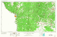
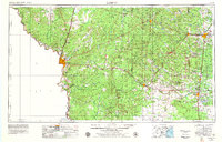
Laredo stands as the primary hub along the Rio Grande in this mid-century survey, which documents the extensive oil and ranching landscape of South Texas. The map illustrates a region transitioning from its traditional rail-based economy to one dominated by petroleum extraction and Cold War aviation. The Texas and Mexican RR and the Missouri Pacific RR provide the backbone for transit, connecting smaller outposts like Hebbronville, San Diego, and Alice. Military operations are prominent near the border, anchored by Laredo AFB and its outlying landing strips, Laredo AFB Aux Field No 1 and Laredo AFB Aux Field No 2. Further east, the terrain is defined by massive petroleum operations such as the Seeligson Oil Field and Government Wells Oil Field, while the southern reaches show the emerging waters of the Falcon Reservoir.
Find a feature on this map
59 named features on this map. Tap any name to fly to it.
Don’t see what you’re looking for? This feature index may not catch every label — zoom into the map to look around manually.
Map Details
Editions of this 1956 Laredo Map
3 editions found
Other maps of this area

1917 · Ben Bolt
USGS Topo · 1:62,500

1920 · Mikeska
USGS Topo · 1:125,000

1920 · San Diego
USGS Topo · 1:62,500

1921 · Falfurrias
USGS Topo · 1:125,000

1923 · Armstrong
USGS Topo · 1:62,500

1923 · Palafox
USGS Topo · 1:62,500

1925 · Mathis No. 3
USGS Topo · 1:48,000

1927 · Mathis
USGS Topo · 1:62,500

1928 · Sarita
USGS Topo · 1:125,000

1929 · Cotulla
USGS Topo · 1:125,000