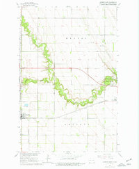
1963 Map of Larimore East
USGS Topo · Published 1977About this map
Larimore and Arvilla anchor this 1963 survey of the Red River Valley’s western edge, where the agricultural grid is interrupted by the winding incision of the Turtle River. The landscape reveals a transition from flat farmland to the wooded riparian corridor preserved within Turtle River State Park. As part of the Department of the Interior program for the development of the Missouri River Basin, the map meticulously records the era's transport infrastructure, most notably the Great Northern railroad running east-west across the plains.
Find a feature on this map
17 named features on this map. Tap any name to fly to it.
Don’t see what you’re looking for? This feature index may not catch every label — zoom into the map to look around manually.
Map Details
Editions of this 1963 Larimore East Map
2 editions found

Other maps of this area

1926 · Ardoch
USGS Topo · 1:62,500

1934 · Emerado
USGS Topo · 1:48,000

1936 · Emerado
USGS Topo · 1:62,500

1936 · Larimore
USGS Topo · 1:62,500

1952 · Grand Forks
USGS Topo · 1:250,000

1952 · Thief River Falls
USGS Topo · 1:250,000

1956 · Thief River Falls
USGS Topo · 1:250,000

1956 · Grand Forks
USGS Topo · 1:250,000

1957 · Thief River Falls
USGS Topo · 1:250,000

1963 · Orr
USGS Topo · 1:24,000