
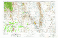
1955 Map of Las Cruces
USGS Topo · Published 1963About this map
The Rio Grande valley serves as the central corridor for this mid-century survey, anchoring the agricultural and educational hub of Las Cruces. This era captures the region's transition into a center for scientific research and aerospace, evidenced by the presence of the California Institute of Technology and proximity to the Holloman Air Force Base. Traditional desert life remains visible through scattered settlements like Hatch, Mesilla, and Dona Ana, while the northern reach of the Franklin Mountains and the dramatic Organ Mountains provide sharp relief against the desert floor.
Find a feature on this map
103 named features on this map. Tap any name to fly to it.
Don’t see what you’re looking for? This feature index may not catch every label — zoom into the map to look around manually.
Map Details
Editions of this 1955 Las Cruces Map
3 editions found
Other maps of this area

1891 · Las Cruces
USGS Topo · 1:125,000

1893 · Las Cruces
USGS Topo · 1:125,000

1896 · El Paso
USGS Topo · 1:125,000

1899 · Deming
USGS Topo · 1:125,000

1903 · Cerro Alto
USGS Topo · 1:125,000

1908 · El Paso
USGS Topo · 1:125,000

1909 · Silver City
USGS Topo · 1:125,000

1911 · Alum Mountain
USGS Topo · 1:125,000

1913 · Alum Mountain
USGS Topo · 1:125,000

1915 · Deming
USGS Topo · 1:125,000