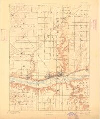
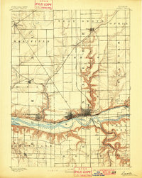
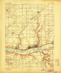
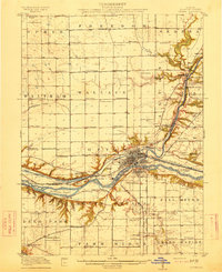
1893 Map of Lasalle
USGS Topo · Published 1908About this map
The Illinois River valley serves as the industrial and transit spine of this Illinois region at the end of the 19th century. Extensive rail infrastructure, including the Chicago Rock Island and Pacific Railroad and the Illinois Central Railroad, converges on the manufacturing centers of La Salle and Peru. Parallel to the river, the Illinois and Michigan Canal remains a visible piece of the transport network, though it is increasingly shadowed by the rapid expansion of the steel and steam lines. To the south, the deep-cut gorge of the Vermilion River and the designated grounds of Deer Park provide a sharp contrast to the surrounding gridded townships. Small agricultural and mining outposts such as Arlington, Ladd, and Oglesby dot the plateau, connected by a web of creeks like Negro Creek and Pecumsaugan Creek that feed into the primary river corridor.
Find a feature on this map
38 named features on this map. Tap any name to fly to it.
Don’t see what you’re looking for? This feature index may not catch every label — zoom into the map to look around manually.
Map Details
Editions of this 1893 Lasalle Map
4 editions found
Other maps of this area

1892 · Ottawa
USGS Topo · 1:62,500

1893 · Lacon
USGS Topo · 1:62,500

1893 · Hennepin
USGS Topo · 1:62,500

1893 · Lasalle
USGS Topo · 1:62,500

1909 · Hennepin
USGS Topo · 1:62,500

1911 · La Salle
USGS Topo · 1:62,500

1911 · Hennepin
USGS Topo · 1:62,500

1913 · La Salle
USGS Topo · 1:62,500
1915 · Ottawa
USGS Topo · 1:62,500

1925 · Streator
USGS Topo · 1:62,500