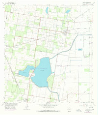
1957 Map of Lasara
USGS Topo · Published 1977About this map
Monte Alto Reservoir dominates the landscape of this South Texas quadrangle, divided into Unit No 1 and Unit No 2 to manage water for the surrounding agricultural plains. The intricate network of the Main Supply Canal and various elevated ditches reveals the critical engineering required to sustain the citrus and row-crop economy of the mid-20th century. The settlement of Lasara sits at a rail junction along the Missouri Pacific line, serving as a focal point for the local community. Further south, the town of Monte Alto borders the reservoir, where the Hidalgo and Willacy Counties Water District No 1 operates essential infrastructure. The map is a valuable resource for genealogists, documenting several local burial sites including Lasara Memorial Cemetery, San Martin Cemetery, and the isolated Graves located near the county line.
Find a feature on this map
21 named features on this map. Tap any name to fly to it.
Don’t see what you’re looking for? This feature index may not catch every label — zoom into the map to look around manually.
Map Details
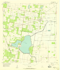
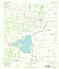
Editions of this 1957 Lasara Map
Other maps of this area

1922 · La Sal Vieja
USGS Topo · 1:62,500

1929 · Santa Rosa
USGS Topo · 1:24,000

1933 · Santa Rosa
USGS Topo · 1:31,680

1939 · Linn
USGS Topo · 1:62,500

1949 · Mc Allen
USGS Topo · 1:250,000

1953 · Brownsville
USGS Topo · 1:250,000

1954 · McAllen
USGS Topo · 1:250,000

1956 · La Sal Vieja
USGS Topo · 1:24,000

1956 · Santa Rosa
USGS Topo · 1:24,000

1956 · Yturria
USGS Topo · 1:24,000