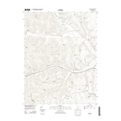
2013 Map of Latham
USGS Topo · Published 2013About this map
Sunfish Creek and its many tributaries, including Chenoweth Fork and Morgan Fork, define the drainage patterns of this Pike County landscape. The settlement of Latham serves as a primary western hub, while smaller communities like Idaho, Elm Grove, and Hatch are scattered along the valley floors and higher elevations. A high concentration of small family and community burial grounds, such as Barton Cem, Shanks Cem, and the Clayton Number 1 Cem, are found throughout the uplands, offering valuable locations for genealogical research. The terrain is marked by numerous named hollows and ridges, such as Wycoff Hollow and Beaver Ridge. Infrastructure is represented by the Appalachian Hwy and landmarks like the Fire Tower on Green Ridge, which overlooks the winding network of local roads and creek beds.
Find a feature on this map
94 named features on this map. Tap any name to fly to it.
Don’t see what you’re looking for? This feature index may not catch every label — zoom into the map to look around manually.
Map Details
Editions of this 2013 Latham Map
This is the sole edition of this map. No revisions or reprints were ever made.
Other maps of this area

1915 · Bainbridge
USGS Topo · 1:48,000

1915 · Otway
USGS Topo · 1:62,500

1915 · Piketon
USGS Topo · 1:62,500

1916 · Peebles
USGS Topo · 1:62,500

1917 · Bainbridge
USGS Topo · 1:62,500

1917 · Piketon
USGS Topo · 1:62,500

1917 · Otway
USGS Topo · 1:62,500

1918 · Peebles
USGS Topo · 1:62,500

1944 · Piketon
USGS Topo · 1:62,500

1947 · Columbus
USGS Topo · 1:250,000