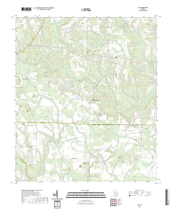
2024 Map of Lax
USGS Topo · Published 2024About this map
The Satilla River flows through this rural landscape on the border of Coffee and Atkinson Counties, defining a region characterized by family-run agriculture and ancestral landholdings. Near the small settlement of Lax, the map reveals a high concentration of family-named cemeteries, including the Lax Cem, Purvis Cem, and Joseph Carver Cem, which serve as vital markers for genealogical research. The terrain is marked by significant wetlands and water bodies such as Dark Bay and Paulk Lake, which influenced the placement of local thoroughfares like Old Coffee RD and Old Columbus RD. The presence of Bridgetown further south illustrates the persistent, decentralized settlement patterns typical of southern Georgia. This map preserves the distinct rural layout of a community where the network of family-named roads, like Mcdonald Paulk RD and Albert Nolan RD, reflects generations of local history tied to the land.
Find a feature on this map
93 named features on this map. Tap any name to fly to it.
Don’t see what you’re looking for? This feature index may not catch every label — zoom into the map to look around manually.
Map Details
Editions of this 2024 Lax Map
This is the sole edition of this map. No revisions or reprints were ever made.
Other maps of this area

1953 · Waycross
USGS Topo · 1:250,000

1958 · Waycross
USGS Topo · 1:250,000

1972 · Tenmile Bay
USGS Topo · 1:24,000

1972 · Kirkland
USGS Topo · 1:24,000

1972 · Willacoochee
USGS Topo · 1:24,000

1972 · Lax
USGS Topo · 1:24,000

1972 · Ambrose
USGS Topo · 1:24,000

1972 · Ocilla East
USGS Topo · 1:24,000

1972 · Mora
USGS Topo · 1:24,000
1977 · Mora
USGS Topo · 1:24,000