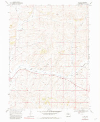
1969 Map of Lay SE
USGS Topo · Published 1983About this map
The semi-arid high country of Northwest Colorado is documented in this 1969 field-checked survey, showing a landscape defined by industrial exploration and seasonal drainage patterns. High-desert watercourses like Lay Creek and Big Gulch dominate the topography, carving paths through the high plateaus of Moffat County. At this time, the area was a focus for energy development, indicated by numerous Drill Holes and scattered Oil Well and Oil Wells markings across the terrain.
Find a feature on this map
12 named features on this map. Tap any name to fly to it.
Don’t see what you’re looking for? This feature index may not catch every label — zoom into the map to look around manually.
Map Details
Editions of this 1969 Lay SE Map
4 editions found
Other maps of this area

1910 · Danforth Hills
USGS Topo · 1:125,000

1912 · Axial
USGS Topo · 1:62,500

1914 · Axial
USGS Topo · 1:62,500

1915 · Monument Butte
USGS Topo · 1:62,500

1916 · Craig
USGS Topo · 1:125,000

1954 · Craig
USGS Topo · 1:250,000

1957 · Craig
USGS Topo · 1:250,000

1958 · Craig
USGS Topo · 1:250,000

1960 · Craig
USGS Topo · 1:250,000

1962 · Craig
USGS Topo · 1:250,000