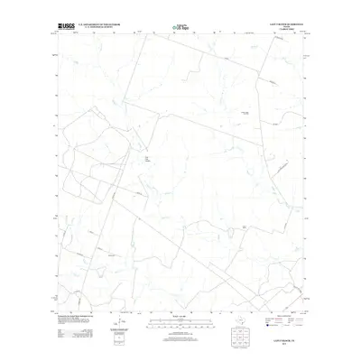
2013 Map of Lazy F Ranch
USGS Topo · Published 2013About this map
Blanco Cr and Medio Cr wind through this rural landscape in Bee County, defining the drainage patterns of a region dominated by ranching and resource extraction. The landscape is characterized by its wide-open ranch lands, including the namesake Lazy F Ranch and the small community of Live Oak Hollow. The area's energy economy is represented by the Dallas-Husky Gas Field in the northeast quadrant, while local heritage is preserved at Colony Cem near Boggy Cr. The transportation network is a mix of farm-to-market roads and named ranch lanes, such as Charco Rd and Oak Creek Ranch RD, which connect these dispersed settlements and industrial sites.
Find a feature on this map
23 named features on this map. Tap any name to fly to it.
Don’t see what you’re looking for? This feature index may not catch every label — zoom into the map to look around manually.
Map Details
Editions of this 2013 Lazy F Ranch Map
This is the sole edition of this map. No revisions or reprints were ever made.
Other maps of this area

1936 · Pettus
USGS Topo · 1:62,500

1953 · Beeville
USGS Topo · 1:250,000

1954 · Skidmore
USGS Topo · 1:62,500

1954 · Fleming
USGS Topo · 1:62,500

1956 · Beeville
USGS Topo · 1:250,000

1956 · Pettus
USGS Topo · 1:62,500

1960 · Beeville
USGS Topo · 1:250,000
1963 · Tuleta
USGS Topo · 1:24,000
1963 · Tulsita
USGS Topo · 1:24,000

1963 · Lazy F Ranch
USGS Topo · 1:24,000