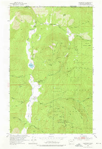
1952 Map of Leadpoint
USGS Topo · Published 1976About this map
The settlement of Leadpoint sits at the base of Red Top Mountain and Gladstone Mountain, serving as a focal point for an era of intense resource extraction along the international border. This map reveals a landscape defined by industrial activity and early homesteading, particularly around the Admiral Mine & Mill and the Hartbauer Orchard. The terrain is characterized by steep ridges like Windy Ridge and Lime Creek Mtn, which are heavily scarred by mining operations such as the Electric Pt Mine, Lead King Mine, and Lucille Mine.
Find a feature on this map
46 named features on this map. Tap any name to fly to it.
Don’t see what you’re looking for? This feature index may not catch every label — zoom into the map to look around manually.
Map Details
Editions of this 1952 Leadpoint Map
3 editions found
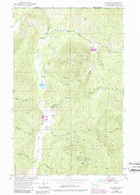
Other maps of this area

1929 · Colville
USGS Topo · 1:125,000

1933 · Colville
USGS Topo · 1:125,000

1934 · Metaline
USGS Topo · 1:125,000

1942 · Metaline
USGS Topo · 1:125,000

1952 · Spirit
USGS Topo · 1:24,000

1952 · Deep Lake
USGS Topo · 1:24,000

1952 · Leadpoint
USGS Topo · 1:24,000

1952 · Boundary
USGS Topo · 1:24,000

1958 · Sandpoint
USGS Topo · 1:250,000

1963 · Sandpoint
USGS Topo · 1:250,000