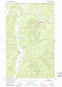
1952 Map of Leadpoint
USGS Topo · Published 1986About this map
The rugged boundary lands of Stevens County are defined by a dense concentration of hard-rock mining sites along the Canadian border. The small settlement of Leadpoint sits at the heart of this mineral-rich corridor, surrounded by high-elevation peaks like Red Top Mountain and Gladstone Mountain. The 1940s and 50s landscape reveals an economy built on timber and extraction within the Colville National Forest, evidenced by the sheer number of named shafts and pits. Of particular note is the cluster of operations such as the Electric Point Mine, the Gladstone Mine, and the Admiral Mine & Mill. The social history of the area is represented by the Cedar Creek Sch (Aband), signaling a shift in the local population. Significant water features including Cedar Lake and the East Fork Cedar Creek drain the steep terrain, while agricultural efforts like the Hartbauer Orchard appear as rare clearings in the otherwise dense woodland.
Find a feature on this map
48 named features on this map. Tap any name to fly to it.
Don’t see what you’re looking for? This feature index may not catch every label — zoom into the map to look around manually.
Map Details
Editions of this 1952 Leadpoint Map
3 editions found
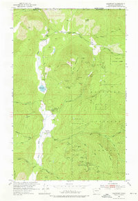
Other maps of this area

1929 · Colville
USGS Topo · 1:125,000

1933 · Colville
USGS Topo · 1:125,000

1934 · Metaline
USGS Topo · 1:125,000

1942 · Metaline
USGS Topo · 1:125,000

1952 · Spirit
USGS Topo · 1:24,000

1952 · Deep Lake
USGS Topo · 1:24,000

1952 · Leadpoint
USGS Topo · 1:24,000

1952 · Boundary
USGS Topo · 1:24,000

1958 · Sandpoint
USGS Topo · 1:250,000

1963 · Sandpoint
USGS Topo · 1:250,000