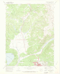
1970 Map of Leadville North
USGS Topo · Published 1973About this map
Leadville stands as the urban anchor of this 1970 landscape, where the high-altitude industrial legacy of the Silver City is meticulously detailed. The map captures the complex interaction between the mining district’s storied geography and the infrastructure of the late 20th century. To the northeast of the town center, the concentration of famous workings at Fryer Hill, including the Matchless Mine, reflects the district's historical wealth. The rugged topography is defined by the Continental Divide and Tennessee Pass, where the Denver and Rio Grande Western Railroad navigates the steep grades.
Find a feature on this map
64 named features on this map. Tap any name to fly to it.
Don’t see what you’re looking for? This feature index may not catch every label — zoom into the map to look around manually.
Map Details
Editions of this 1970 Leadville North Map
4 editions found
Other maps of this area

1889 · Leadville
USGS Topo · 1:125,000

1891 · Leadville
USGS Topo · 1:125,000

1934 · Climax
USGS Topo · 1:48,000

1935 · Mount Elbert
USGS Topo · 1:62,500

1938 · Mt. Lincoln
USGS Topo · 1:48,000

1938 · Mount Elbert
USGS Topo · 1:62,500

1939 · Mount Elbert
USGS Topo · 1:62,500

1942 · Leadville
USGS Topo · 1:125,000

1945 · Mount Lincoln
USGS Topo · 1:62,500

1949 · Holy Cross
USGS Topo · 1:62,500