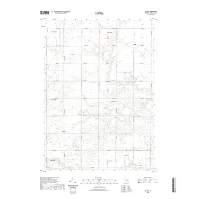
2019 Map of Leaton
USGS Topo · Published 2019About this map
The Nottawa Indian Cem stands as a significant cultural landmark in the center of this Isabella County landscape, situated near the headwaters of the N Br Salt River. The region is defined by a dense network of agricultural and natural waterways, including McDonald Drain and Sharps Drain, which reflect a long-standing history of land management and drainage in central Michigan. Small rural settlements like Wise, Delwin, and Leaton are distributed along a grid of section roads such as E Rosebush Rd and E Beal City Rd. Further south, the terrain transitions toward the Chippewa River corridor near Jordan. This late-2010s survey captures the enduring rural character of the township, where isolated cemeteries like Bissing Cem and various small drains like Lowe Drain provide specific points of interest for local historians and genealogists studying the area's development.
Find a feature on this map
36 named features on this map. Tap any name to fly to it.
Don’t see what you’re looking for? This feature index may not catch every label — zoom into the map to look around manually.
Map Details
Editions of this 2019 Leaton Map
This is the sole edition of this map. No revisions or reprints were ever made.
Other maps of this area

1916 · Mount Pleasant
USGS Topo · 1:62,500

1919 · Mount Pleasant
USGS Topo · 1:62,500

1930 · Shepherd
USGS Topo · 1:48,000

1936 · Shepherd
USGS Topo · 1:62,500

1943 · Mount Pleasant
USGS Topo · 1:62,500

1954 · Midland
USGS Topo · 1:250,000

1958 · Midland
USGS Topo · 1:250,000

1959 · Midland
USGS Topo · 1:250,000

1959 · Clare
USGS Topo · 1:62,500

1966 · Midland
USGS Topo · 1:250,000