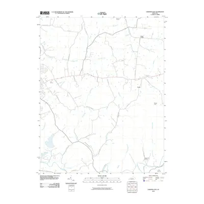
2010 Map of Lebanon East
USGS Topo · Published 2010About this map
Rolling Fork and its diverse tributaries define the landscape east of Lebanon, where agricultural land meets the winding waterways of Marion County. The drainage network is particularly dense here, featuring curiously named streams like Milk and Mush Creek alongside North Rolling Fork and Caney Creek. The terrain is punctuated by prominent landmarks such as Putnam Knob and the geographic pinch point known as The Narrows. Small community clusters like Penick and Poplar Corner serve as local anchors, while the presence of Ryder Cemetery and Saint Ives Cemetery provides points of interest for genealogists tracing family roots in the area. A network of rural lanes, including Helm Schoolhouse Rd and Popes Creek Rd, suggests the historical locations of early educational sites and family homesteads that have shaped this Kentucky countryside.
Find a feature on this map
46 named features on this map. Tap any name to fly to it.
Don’t see what you’re looking for? This feature index may not catch every label — zoom into the map to look around manually.
Map Details
Editions of this 2010 Lebanon East Map
This is the sole edition of this map. No revisions or reprints were ever made.
Other maps of this area

1952 · Bradfordsville
USGS Topo · 1:24,000

1953 · Mackville
USGS Topo · 1:24,000

1953 · Bradfordsville NE
USGS Topo · 1:24,000

1953 · Gravel Switch
USGS Topo · 1:24,000

1953 · Saint Catharine
USGS Topo · 1:24,000

1953 · Lebanon East
USGS Topo · 1:24,000

1953 · Springfield
USGS Topo · 1:24,000

1953 · Spurlington
USGS Topo · 1:24,000

1953 · Lebanon West
USGS Topo · 1:24,000

1953 · Bradfordsville
USGS Topo · 1:24,000