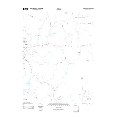
2013 Map of Lebanon East
USGS Topo · Published 2013About this map
The city of Lebanon serves as the focal point for this Marion County survey, where the urban grid meets the agricultural landscape of central Kentucky. Toward the outskirts, the topography transitions from the residential streets of Taylor Ave and S Spalding Ave to the rolling terrain surrounding Colgans Hill. The drainage patterns are defined by the Rolling Fork and several of its tributaries, including Milk and Mush Cr and Pontchartrain Cr, which help shape the local geography and the placement of rural outposts like Penick and Poplar Corner.
Find a feature on this map
103 named features on this map. Tap any name to fly to it.
Don’t see what you’re looking for? This feature index may not catch every label — zoom into the map to look around manually.
Map Details
Editions of this 2013 Lebanon East Map
This is the sole edition of this map. No revisions or reprints were ever made.
Other maps of this area

1952 · Bradfordsville
USGS Topo · 1:24,000

1953 · Mackville
USGS Topo · 1:24,000

1953 · Bradfordsville NE
USGS Topo · 1:24,000

1953 · Gravel Switch
USGS Topo · 1:24,000

1953 · Saint Catharine
USGS Topo · 1:24,000

1953 · Lebanon East
USGS Topo · 1:24,000

1953 · Springfield
USGS Topo · 1:24,000

1953 · Spurlington
USGS Topo · 1:24,000

1953 · Lebanon West
USGS Topo · 1:24,000

1953 · Bradfordsville
USGS Topo · 1:24,000