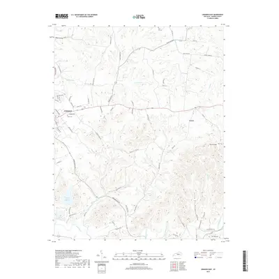
2019 Map of Lebanon East
USGS Topo · Published 2019About this map
Lebanon serves as the focal point of this Marion County landscape, situated where the urban grid meets the deeply dissected hills of the Knobs region. The terrain to the south and east is defined by winding drainage patterns like Turkey Pen Hollow and Rogue Hollow, where local family history is anchored by sites such as Saint Ivos Cem and Tatum Cem. This modern topographic survey illustrates the enduring rural character of the area, punctuated by the waters of Fagan Branch Reservoir and Marion County Lake. Land use patterns are clearly visible through the naming of long-established thoroughfares such as Helm School House Rd and Short Line Pike, which connect the settlement at Penick to the county seat. The map provides a detailed view of the complex hydrography feeding the Rolling Fork, showing how the creek valleys and ridges like Putnam Knob have dictated the local road network and settlement patterns for generations.
Find a feature on this map
76 named features on this map. Tap any name to fly to it.
Don’t see what you’re looking for? This feature index may not catch every label — zoom into the map to look around manually.
Map Details
Editions of this 2019 Lebanon East Map
This is the sole edition of this map. No revisions or reprints were ever made.
Other maps of this area

1952 · Bradfordsville
USGS Topo · 1:24,000

1953 · Mackville
USGS Topo · 1:24,000

1953 · Bradfordsville NE
USGS Topo · 1:24,000

1953 · Gravel Switch
USGS Topo · 1:24,000

1953 · Saint Catharine
USGS Topo · 1:24,000

1953 · Lebanon East
USGS Topo · 1:24,000

1953 · Springfield
USGS Topo · 1:24,000

1953 · Spurlington
USGS Topo · 1:24,000

1953 · Lebanon West
USGS Topo · 1:24,000

1953 · Bradfordsville
USGS Topo · 1:24,000