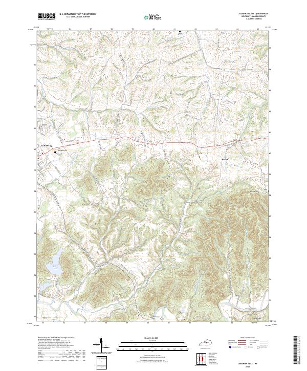
2022 Map of Lebanon East
USGS Topo · Published 2022About this map
The city of Lebanon serves as the focal point for this survey of central Kentucky, where the urban street grid gives way to a complex system of ridges and hollows. The landscape is defined by the winding course of the Rolling Fork and its tributaries, including the curiously named Milk and Mush Cr and North Rolling Fork. To the east, the small settlement of Penick sits near the base of Putnam Knob, marking a transition into more deeply dissected terrain.
Find a feature on this map
82 named features on this map. Tap any name to fly to it.
Don’t see what you’re looking for? This feature index may not catch every label — zoom into the map to look around manually.
Map Details
Editions of this 2022 Lebanon East Map
This is the sole edition of this map. No revisions or reprints were ever made.
Other maps of this area

1952 · Bradfordsville
USGS Topo · 1:24,000

1953 · Mackville
USGS Topo · 1:24,000

1953 · Bradfordsville NE
USGS Topo · 1:24,000

1953 · Gravel Switch
USGS Topo · 1:24,000

1953 · Saint Catharine
USGS Topo · 1:24,000

1953 · Lebanon East
USGS Topo · 1:24,000

1953 · Springfield
USGS Topo · 1:24,000

1953 · Spurlington
USGS Topo · 1:24,000

1953 · Lebanon West
USGS Topo · 1:24,000

1953 · Bradfordsville
USGS Topo · 1:24,000