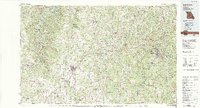
1982 Map of Lebanon
USGS Topo · Published 1983About this map
Fort Leonard Wood Military Reservation dominates the eastern landscape of this early 1980s Missouri Ozarks study, a period when the regional infrastructure of Interstate 44 and the St Louis-San Francisco railroad defined the corridor between Lebanon and Waynesville. The map illustrates a transition from the structured military presence near St Robert to the deeply winding river systems of the Niangua and Gasconade.
Find a feature on this map
79 named features on this map. Tap any name to fly to it.
Don’t see what you’re looking for? This feature index may not catch every label — zoom into the map to look around manually.
Map Details
Editions of this 1982 Lebanon Map
This is the sole edition of this map. No revisions or reprints were ever made.
Other maps of this area

1884 · Springfield
USGS Topo · 1:125,000

1884 · Bolivar
USGS Topo · 1:125,000

1886 · Springfield
USGS Topo · 1:125,000

1887 · Warsaw
USGS Topo · 1:125,000

1888 · Versailles
USGS Topo · 1:125,000

1888 · Tuscumbia
USGS Topo · 1:125,000

1892 · Bolivar
USGS Topo · 1:125,000

1893 · Versailles
USGS Topo · 1:125,000

1894 · Warsaw
USGS Topo · 1:125,000

1894 · Tuscumbia
USGS Topo · 1:125,000