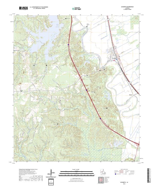
2024 Map of Lecompte
USGS Topo · Published 2024About this map
Lecompte and the settlement of Meeker sit at the edge of the Red River valley, where the agricultural flats of Bayou Boeuf meet the rising piney woods of central Louisiana. This 2024 landscape is defined by the sharp contrast between the rectilinear field patterns of the bottomlands and the winding creek systems of the west, including Chinquapin Creek and Cockrell Creek. The area's deep family roots are visible in the numerous small burial grounds such as Wilmer Memorial Cem, Ballard Cem, and Linzay Cem that dot the countryside. Along the eastern edge, the topography descends into the wetlands of Mathews Brake and the protected terrain of the Lake Ophelia National Wildlife Refuge. In the northwest, the Indian Creek Reservoir provides a major water feature among the timbered hills accessed by roads like Indian Hill Rd and Martin Springs Rd.
Find a feature on this map
87 named features on this map. Tap any name to fly to it.
Don’t see what you’re looking for? This feature index may not catch every label — zoom into the map to look around manually.
Map Details
Editions of this 2024 Lecompte Map
This is the sole edition of this map. No revisions or reprints were ever made.
Other maps of this area

1935 · Turkey Creek
USGS Topo · 1:62,500

1935 · Lecompte
USGS Topo · 1:62,500

1942 · Oakdale
USGS Topo · 1:62,500

1949 · Glenmora
USGS Topo · 1:31,680

1949 · Turkey Creek
USGS Topo · 1:62,500

1952 · Lake Charles
USGS Topo · 1:250,000

1953 · Alexandria
USGS Topo · 1:250,000

1954 · Lake Charles
USGS Topo · 1:250,000

1955 · Alexandria
USGS Topo · 1:250,000

1956 · Forest Hill
USGS Topo · 1:62,500