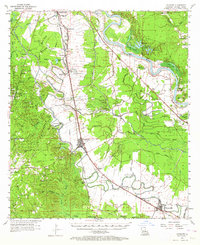
1957 Map of Lecompte
USGS Topo · Published 1964About this map
The Red River corridor southeast of Alexandria defines this mid-century landscape, where a dense network of bayous and sloughs supports a rich agricultural and timber economy. Heavy rail infrastructure, including the Rock Island and Pacific and Texas and Pacific, links established settlements like Lecompte and Cheneyville to the regional market. To the west, the Alexandria State Forest provides a contrast to the plantation lands, housing the Fish Hatchery and numerous early spiritual sites like Mt Lebanon Ch. Family and community history is preserved in a high concentration of cemeteries, such as Spring Hill Cem and Hawkins Cem, which sit alongside the Louisiana Meridian. The map captures the transition from old river-bottom plantations to modern research hubs like the Dean Lee Agricultural Center, all while maintaining its complex water-bound geography through features like Bayou Boeuf and Chatlin Lake.
Find a feature on this map
80 named features on this map. Tap any name to fly to it.
Don’t see what you’re looking for? This feature index may not catch every label — zoom into the map to look around manually.
Map Details
Editions of this 1957 Lecompte Map
3 editions found

Other maps of this area

1935 · Turkey Creek
USGS Topo · 1:62,500

1935 · Lecompte
USGS Topo · 1:62,500

1940 · Marksville
USGS Topo · 1:62,500

1941 · Alexandria
USGS Topo · 1:62,500

1941 · Buckeye
USGS Topo · 1:62,500

1941 · Boyce
USGS Topo · 1:62,500

1942 · Oakdale
USGS Topo · 1:62,500

1945 · Boyce SE
USGS Topo · 1:31,680

1948 · Bunkie
USGS Topo · 1:62,500

1949 · Glenmora
USGS Topo · 1:31,680