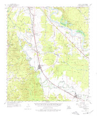
1957 Map of Lecompte
USGS Topo · Published 1977About this map
The low-lying alluvial plains of Rapides Parish are defined by an intricate network of waterways like Bayou Boeuf and Bayou Lamourie as they appeared in the late 1950s. The landscape is a mix of agricultural intensity and managed timberland, with the Kisatchie National Forest and Alexander State Forest occupying the western uplands. Transport infrastructure dominates the valley floor, where the Missouri Pacific and Texas and Pacific railroads parallel the bayous, connecting settlements like Lecompte and Cheneyville.
Find a feature on this map
111 named features on this map. Tap any name to fly to it.
Don’t see what you’re looking for? This feature index may not catch every label — zoom into the map to look around manually.
Map Details
Editions of this 1957 Lecompte Map
3 editions found

Other maps of this area

1935 · Turkey Creek
USGS Topo · 1:62,500

1935 · Lecompte
USGS Topo · 1:62,500

1940 · Marksville
USGS Topo · 1:62,500

1941 · Alexandria
USGS Topo · 1:62,500

1941 · Buckeye
USGS Topo · 1:62,500

1941 · Boyce
USGS Topo · 1:62,500

1942 · Oakdale
USGS Topo · 1:62,500

1945 · Boyce SE
USGS Topo · 1:31,680

1948 · Bunkie
USGS Topo · 1:62,500

1949 · Glenmora
USGS Topo · 1:31,680