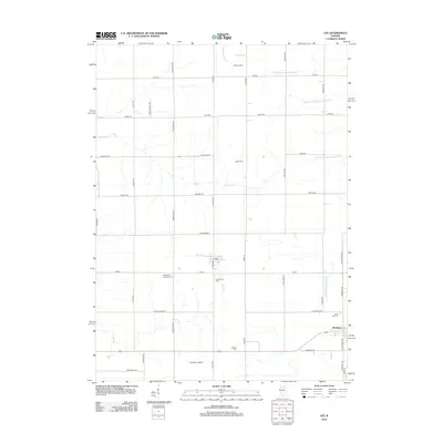
2012 Map of Lee
USGS Topo · Published 2012About this map
The community of Lee and the village of Shabbona anchor this portrait of the Illinois prairie in the early 21st century. The landscape is defined by the headwaters of the Kishwaukee River system, including the N Br S Br Kishwaukee River, Middle Br S Br Kishwaukee River, and S Br S Br Kishwaukee River, which weave through a grid of agricultural section roads. This survey is particularly useful for genealogists, as it documents several historic burial grounds including Norwegian Lutheran Cem, Lee Calvary Cem, English Cem, Union Cem, and Rose Hill Cem. Large agricultural operations like Nordic Farms and Gogoi Farm reflect the area's continued farming heritage, while the Winterton Airport provides a modern navigational landmark amidst the sprawling drainage of Steward Cr and Dry Run.
Find a feature on this map
45 named features on this map. Tap any name to fly to it.
Don’t see what you’re looking for? This feature index may not catch every label — zoom into the map to look around manually.
Map Details
Editions of this 2012 Lee Map
This is the sole edition of this map. No revisions or reprints were ever made.
Other maps of this area

1934 · De Kalb
USGS Topo · 1:62,500

1937 · De Kalb
USGS Topo · 1:62,500

1951 · Earlville
USGS Topo · 1:62,500

1952 · Rochelle
USGS Topo · 1:62,500

1952 · Mendota
USGS Topo · 1:62,500

1958 · Aurora
USGS Topo · 1:250,000

1961 · Aurora
USGS Topo · 1:250,000
1971 · Lee
USGS Topo · 1:24,000
1971 · Paw Paw
USGS Topo · 1:24,000
1971 · Waterman
USGS Topo · 1:24,000