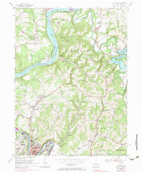
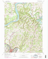
1954 Map of Leechburg
USGS Topo · Published 1983About this map
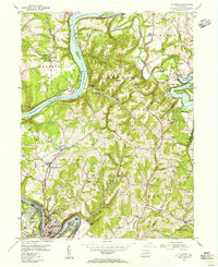
The Allegheny River and Kiskiminetas River converge at the heart of this mid-century topographic study, defining the industrial and residential boundaries of Leechburg and West Leechburg. Along the riverbanks, the Penn Central and Shawmut And Pittsburgh RR tracks trace the corridor of heavy transport that sustained local settlements like Logansport and Kelly Station. To the north, the landscape shifts toward recreation and conservation at Crooked Creek State Park, where the Crooked Creek Reservoir is a prominent feature. The rural interior of Gilpin and Bethel townships is dotted with landmarks of community life, including the Forks Church, Hills Consolidated Sch, and family-named points like Cooks Summit. Numerous gas wells, sand pits, and strip mines are scattered across the terrain, illustrating the region's long-standing reliance on extraction and natural resource management during this era.
Find a feature on this map
72 named features on this map. Tap any name to fly to it.
Don’t see what you’re looking for? This feature index may not catch every label — zoom into the map to look around manually.
Map Details
Editions of this 1954 Leechburg Map
5 editions found
Other maps of this area

1900 · Kittanning
USGS Topo · 1:62,500

1901 · Rural Valley
USGS Topo · 1:62,500

1902 · Kittanning
USGS Topo · 1:62,500

1902 · Elders Ridge
USGS Topo · 1:62,500

1903 · Rural Valley
USGS Topo · 1:62,500

1904 · Elders Ridge
USGS Topo · 1:62,500

1907 · Freeport
USGS Topo · 1:62,500

1909 · Freeport
USGS Topo · 1:62,500

1953 · Pittsburgh
USGS Topo · 1:250,000

1953 · New Kensington East
USGS Topo · 1:24,000