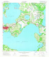
1965 Map of Leesburg East
USGS Topo · Published 1966About this map
The aquatic geography of Central Florida dominates this mid-1960s survey, where the sprawling waters of Lake Harris, Lake Griffin, and Lake Eustis converge. The city of Leesburg serves as the regional hub, situated on the narrow land bridge between the lakes. Transport and industry are closely linked to the terrain, with the Atlantic Coast Line and Seaboard Air Line railroads threading through groves and past localized industrial sites like the sandpits near Leesburg Airport.
Find a feature on this map
51 named features on this map. Tap any name to fly to it.
Don’t see what you’re looking for? This feature index may not catch every label — zoom into the map to look around manually.
Map Details
Editions of this 1965 Leesburg East Map
3 editions found
Other maps of this area

1955 · Orlando
USGS Topo · 1:250,000

1957 · Orlando
USGS Topo · 1:250,000

1958 · Orlando
USGS Topo · 1:250,000

1962 · Orlando
USGS Topo · 1:250,000

1962 · Astatula
USGS Topo · 1:24,000

1965 · Leesburg East
USGS Topo · 1:24,000

1965 · Umatilla
USGS Topo · 1:24,000

1966 · Leesburg West
USGS Topo · 1:24,000
1966 · Lady Lake
USGS Topo · 1:24,000
1966 · Eustis
USGS Topo · 1:24,000