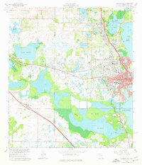
1966 Map of Leesburg West
USGS Topo · Published 1967About this map
The western edge of Leesburg and the growing community of Fruitland Park dominate this mid-1960s survey, illustrating a landscape transitioning between central Florida's citrus groves and its sprawling lake systems. The Seaboard Coast Line railroad creates a distinctive diagonal axis through the terrain, connecting the smaller settlements of Bamboo and Whitney to the regional hub of Leesburg. This era shows significant civic and educational development, with the presence of Carver Heights High Sch, Leesburg High Sch, and Rimes Sch marking the period's residential expansion.
Find a feature on this map
81 named features on this map. Tap any name to fly to it.
Don’t see what you’re looking for? This feature index may not catch every label — zoom into the map to look around manually.
Map Details
Editions of this 1966 Leesburg West Map
5 editions found

Other maps of this area

1893 · Panasoffkee
USGS Topo · 1:62,500

1895 · Panasoffkee
USGS Topo · 1:62,500

1955 · Plant City
USGS Topo · 1:250,000

1955 · Orlando
USGS Topo · 1:250,000

1957 · Orlando
USGS Topo · 1:250,000

1958 · Orlando
USGS Topo · 1:250,000

1958 · Plant City
USGS Topo · 1:250,000

1958 · Bushnell
USGS Topo · 1:24,000

1959 · Plant City
USGS Topo · 1:250,000

1962 · Orlando
USGS Topo · 1:250,000