
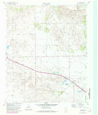
1962 Map of Lelia Lake
USGS Topo · Published 1963About this map
The FT Worth and Denver railroad corridor defines the development of this Texas Panhandle landscape, cutting a diagonal path between the settlements of Clarendon and Lelia Lake. This early 1960s survey captures a region where water management and rail transport intersect, evidenced by the numerous catchment areas like Johnson Lake, Taylor Lakes, and Cattail Lake situated south of the tracks.
Find a feature on this map
16 named features on this map. Tap any name to fly to it.
Don’t see what you’re looking for? This feature index may not catch every label — zoom into the map to look around manually.
Map Details
Editions of this 1962 Lelia Lake Map
2 editions found
Other maps of this area

1954 · Amarillo
USGS Topo · 1:250,000

1954 · Plainview
USGS Topo · 1:250,000

1958 · Amarillo
USGS Topo · 1:250,000

1958 · Plainview
USGS Topo · 1:250,000

1959 · Lelia Lake Creek
USGS Topo · 1:24,000

1959 · Troublesome Creek
USGS Topo · 1:24,000

1962 · Roach Ranch
USGS Topo · 1:24,000

1962 · Griffin Ranch
USGS Topo · 1:24,000

1963 · Hedley
USGS Topo · 1:24,000

1963 · Clarendon
USGS Topo · 1:24,000