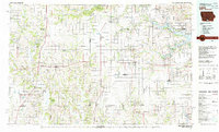
1981 Map of Leon
USGS Topo · Published 1982About this map
The Iowa Missouri state line bisects this 1981 survey, where the rolling agricultural uplands of southern Iowa meet the northern reaches of Missouri. Centered on the town of Leon, the landscape is defined by the headwaters of numerous southward-draining systems including the Thompson River, the Weldon River, and the Grand River. In the east, the sprawling waters of Rathbun Lake create a significant recreational hub near the Monroe and Appanoose county border.
Find a feature on this map
121 named features on this map. Tap any name to fly to it.
Don’t see what you’re looking for? This feature index may not catch every label — zoom into the map to look around manually.
Map Details
Editions of this 1981 Leon Map
This is the sole edition of this map. No revisions or reprints were ever made.
Other maps of this area

1912 · Green City
USGS Topo · 1:62,500

1914 · Green City
USGS Topo · 1:62,500

1918 · Chariton
USGS Topo · 1:62,500

1924 · Melcher
USGS Topo · 1:62,500

1929 · Albia
USGS Topo · 1:62,500

1934 · Humeston
USGS Topo · 1:48,000

1935 · Russell
USGS Topo · 1:62,500

1937 · Corydon
USGS Topo · 1:62,500

1938 · Russell
USGS Topo · 1:62,500

1939 · Centerville
USGS Topo · 1:62,500