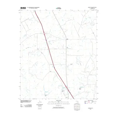
2010 Map of Leona SW
USGS Topo · Published 2010About this map
Cross Roads serves as a central point in this Madison County landscape, where the Osr Hwy and Greenbriar Rd intersect amidst a network of rural lanes and family-named thoroughfares. The topography is defined by the drainage of Larrison Creek and its many tributaries, including Mustang Creek and Greenbriar Creek, which feed into local reservoirs like Walker Lake Number 2 and Fisherman Paradise Lake. Evidence of the region's petroleum industry is visible at the OSR Oil Field in the northeast. Genealogists will find several burial sites preserved across the countryside, including Greer Cemetery, Mount Tabor Cemetery, and Greenbriar Cemetery. The presence of Hensarling Airport further illustrates the modern utility of this agricultural and industrial corridor during the early 21st century.
Find a feature on this map
49 named features on this map. Tap any name to fly to it.
Don’t see what you’re looking for? This feature index may not catch every label — zoom into the map to look around manually.
Map Details
Editions of this 2010 Leona SW Map
This is the sole edition of this map. No revisions or reprints were ever made.
Other maps of this area

1931 · Iola
USGS Topo · 1:62,500

1953 · Palestine
USGS Topo · 1:250,000

1954 · Waco
USGS Topo · 1:250,000

1954 · Beaumont
USGS Topo · 1:250,000

1954 · Austin
USGS Topo · 1:250,000

1955 · Waco
USGS Topo · 1:250,000

1957 · Beaumont
USGS Topo · 1:250,000

1957 · Palestine
USGS Topo · 1:250,000

1962 · Connor
USGS Topo · 1:24,000

1963 · Madisonville
USGS Topo · 1:24,000