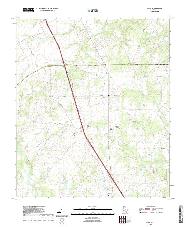
2022 Map of Leona SW
USGS Topo · Published 2022About this map
The Leon and Madison county line bisects this portion of the Texas landscape, following the historic corridor of the Old San Antonio Rd. This thoroughfare, a modern descendant of the ancient Camino Real, remains a defining boundary for local landowners and researchers. The terrain is characterized by a dense network of small watercourses, including Greenbriar Cr and Larrison Cr, which feed into larger impoundments like Walker Lake Number 1 and Fisherman Paradise Lake. Genealogists will find significant value in the scattered family and community burial grounds documented here, such as Greenbriar Cem, the Williams Family Cem, and Mount Tabor Cem. These sites, along with rural landmarks like Hensarling Airport, provide concrete points of reference for tracing family roots and historical land tracts in this rural corridor of East Central Texas.
Find a feature on this map
65 named features on this map. Tap any name to fly to it.
Don’t see what you’re looking for? This feature index may not catch every label — zoom into the map to look around manually.
Map Details
Editions of this 2022 Leona SW Map
This is the sole edition of this map. No revisions or reprints were ever made.
Other maps of this area

1931 · Iola
USGS Topo · 1:62,500

1953 · Palestine
USGS Topo · 1:250,000

1954 · Waco
USGS Topo · 1:250,000

1954 · Beaumont
USGS Topo · 1:250,000

1954 · Austin
USGS Topo · 1:250,000

1955 · Waco
USGS Topo · 1:250,000

1957 · Beaumont
USGS Topo · 1:250,000

1957 · Palestine
USGS Topo · 1:250,000

1962 · Connor
USGS Topo · 1:24,000

1963 · Madisonville
USGS Topo · 1:24,000