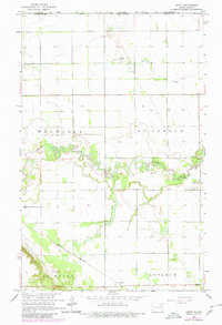
1964 Map of Leroy
USGS Topo · Published 1980About this map
The Pembina River carves a deeply meandering path through the northern plains on this borderland survey, marking a distinct physical contrast to the rigid grid of the surrounding agricultural townships. Positioned just south of the Canada United States international boundary, the area is defined by the intersection of early rail transport and small rural hubs. The settlement of Leroy serves as a local focal point near the river's bend, where the St Joseph Cem provides a genealogical touchstone for the surrounding St Joseph and Walhalla districts. To the south, the Great Northern railroad cuts a diagonal line across the landscape, passing through Leyden and connecting the townships of La Moure and Advance. These features together illustrate a late-twentieth-century landscape of established grain farming and localized rail commerce.
Find a feature on this map
14 named features on this map. Tap any name to fly to it.
Don’t see what you’re looking for? This feature index may not catch every label — zoom into the map to look around manually.
Map Details
Editions of this 1964 Leroy Map
2 editions found
Other maps of this area

1918 · Walhalla
USGS Topo · 1:62,500

1939 · Cavalier
USGS Topo · 1:62,500

1941 · Cavalier
USGS Topo · 1:62,500

1943 · Walhalla
USGS Topo · 1:62,500

1952 · Thief River Falls
USGS Topo · 1:250,000

1956 · Thief River Falls
USGS Topo · 1:250,000

1957 · Thief River Falls
USGS Topo · 1:250,000

1964 · Hallson
USGS Topo · 1:24,000

1964 · Leroy
USGS Topo · 1:24,000

1964 · Walhalla
USGS Topo · 1:24,000