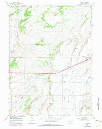
1965 Map of Leroy
USGS Topo · Published 1979About this map
Leroy serves as a central point of interest in this Uinta County landscape, situated along the vital Union Pacific rail line. The map captures an era of resource extraction and water management, evidenced by the numerous borrow pits, gravel pits, and an extensive network of irrigation features like the Oasis Ditch, Bigelow Ditch, and Rock Hollow Ditch. These man-made improvements speak to the effort of sustaining livestock and industry in the high plains environment.
Find a feature on this map
35 named features on this map. Tap any name to fly to it.
Don’t see what you’re looking for? This feature index may not catch every label — zoom into the map to look around manually.
Map Details
Editions of this 1965 Leroy Map
2 editions found
Other maps of this area

1954 · Ogden
USGS Topo · 1:250,000

1958 · Ogden
USGS Topo · 1:250,000

1960 · Ogden
USGS Topo · 1:250,000

1964 · Fort Bridger
USGS Topo · 1:24,000

1964 · Carter
USGS Topo · 1:24,000
1964 · Robertson
USGS Topo · 1:24,000

1965 · Bridger
USGS Topo · 1:24,000

1965 · Ragan
USGS Topo · 1:24,000

1965 · Leroy
USGS Topo · 1:24,000

1965 · Meadow Draw
USGS Topo · 1:24,000