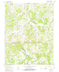
1966 Map of Leslie
USGS Topo · Published 1980About this map
The Bourbeuse River and Meramec River converge in the southern portion of this Franklin County landscape, shaping a terrain defined by sharp river bends and rising bluffs. The rail corridor of the Chicago Rock Island And Pacific serves as the primary east-west axis, connecting the established settlements of Leslie and Beaufort. These towns are surrounded by a network of rural landmarks, including the Beaufort Lookout Tower and localized industry such as several Quarry and Claypit sites that indicate the area's geological utility during the mid-1960s.
Find a feature on this map
36 named features on this map. Tap any name to fly to it.
Don’t see what you’re looking for? This feature index may not catch every label — zoom into the map to look around manually.
Map Details
Editions of this 1966 Leslie Map
2 editions found
Other maps of this area

1890 · Hermann
USGS Topo · 1:125,000

1903 · Sullivan
USGS Topo · 1:125,000

1935 · Gerald
USGS Topo · 1:48,000

1936 · Hermann
USGS Topo · 1:48,000

1941 · Gerald
USGS Topo · 1:62,500

1942 · Hermann
USGS Topo · 1:62,500

1944 · Gerald
USGS Topo · 1:62,500

1945 · Hermann
USGS Topo · 1:62,500

1946 · Union
USGS Topo · 1:62,500

1948 · Union
USGS Topo · 1:62,500