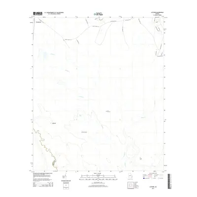
2014 Map of Letford
USGS Topo · Published 2014About this map
Pembroke sits at the northwestern edge of this coastal plain landscape, where the town's grid meets the branching waterways of Bryan County. The southern portion of the quadrangle is defined by the winding course of the Canoochee River, which forms the border with Liberty County and creates low-lying features like Hilliard Island. Local transit is anchored by Ga-119 and Ga-67, connecting the rural community of Letford to the surrounding agricultural and timber lands. Genealogists and local historians will find significant landmarks such as Little Creek Cem and Corinth Cem, which are situated near the slow-moving waters of Savage Cr and Malden Br. The terrain is characterized by numerous small basins and swampy reaches, illustrated by names like Jones Lake, reflecting the hydrological complexity of the Georgia lowcountry at the start of the twenty-first century.
Find a feature on this map
30 named features on this map. Tap any name to fly to it.
Don’t see what you’re looking for? This feature index may not catch every label — zoom into the map to look around manually.
Map Details
Editions of this 2014 Letford Map
This is the sole edition of this map. No revisions or reprints were ever made.
Other maps of this area

1918 · Hinesville
USGS Topo · 1:62,500

1920 · Pembroke
USGS Topo · 1:62,500

1920 · Meldrim
USGS Topo · 1:62,500

1920 · Limerick
USGS Topo · 1:62,500

1942 · Meldrim
USGS Topo · 1:62,500

1944 · Hinesville
USGS Topo · 1:62,500

1944 · Limerick
USGS Topo · 1:62,500

1946 · Brunswick
USGS Topo · 1:250,000

1947 · Savannah
USGS Topo · 1:250,000

1948 · Brunswick
USGS Topo · 1:250,000