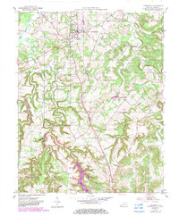
1951 Map of Lewisburg
USGS Topo · Published 1983About this map
Lewisburg serves as the central hub of this northern Logan County landscape, where the Seaboard System railroad tracks bisect the town and link it to outlying settlements like Jerico and Edwards. The terrain is defined by the winding course of the Mud River and its numerous tributaries, including Wolf Lick Creek and Chitty CREEK. This 1951 survey, with 1980s updates, documents a rural community centered on agriculture and localized extraction, evidenced by Oil Wells noted near the northern boundary.
Find a feature on this map
31 named features on this map. Tap any name to fly to it.
Don’t see what you’re looking for? This feature index may not catch every label — zoom into the map to look around manually.
Map Details
Editions of this 1951 Lewisburg Map
2 editions found
Other maps of this area

1911 · Drakesboro
USGS Topo · 1:48,000

1911 · Dunmor
USGS Topo · 1:48,000

1913 · Drakesboro
USGS Topo · 1:62,500

1914 · Dunmor
USGS Topo · 1:62,500

1950 · Olmstead
USGS Topo · 1:24,000

1951 · Olmstead
USGS Topo · 1:24,000

1951 · Lewisburg
USGS Topo · 1:24,000

1951 · Homer
USGS Topo · 1:24,000

1952 · Russellville
USGS Topo · 1:24,000

1952 · Sharon Grove
USGS Topo · 1:24,000