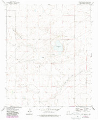
1973 Map of Lewiston Lake
USGS Topo · Published 1987About this map
Lewiston Lake (Salt) sits as a central geographic feature in this corner of Roosevelt County, where the High Plains landscape is defined by intermittent drainage and land management systems. The map, based on 1970s aerial photography with 1980s updates, documents the structural layout of the region during a period of agricultural and utility expansion. Significant terrain features such as Rabbit Hollow and the broad Boone Draw reveal the natural flow of water across the territory, while a long-distance Pipeline and numerous marked Well sites indicate the importance of water and resource extraction to the local economy. The transition between the T. 2 S. and T. 3 S. townships is clearly marked, providing a clear reference for those researching land ownership or property boundaries in this specific section of the Llano Estacado.
Find a feature on this map
8 named features on this map. Tap any name to fly to it.
Don’t see what you’re looking for? This feature index may not catch every label — zoom into the map to look around manually.
Map Details
Editions of this 1973 Lewiston Lake Map
2 editions found
Other maps of this area

1954 · Clovis
USGS Topo · 1:250,000

1954 · Brownfield
USGS Topo · 1:250,000

1958 · Brownfield
USGS Topo · 1:250,000

1958 · Clovis
USGS Topo · 1:250,000

1962 · Brownfield
USGS Topo · 1:250,000

1973 · Floyd
USGS Topo · 1:24,000

1973 · Lewiston Lake
USGS Topo · 1:24,000

1973 · Gammil Well SE
USGS Topo · 1:24,000

1973 · Gammil Well NE
USGS Topo · 1:24,000

1973 · Upton
USGS Topo · 1:24,000