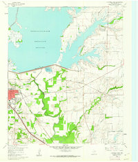
1960 Map of Lewisville East
USGS Topo · Published 1962About this map
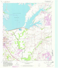
Garza-Little Elm Reservoir dominates the northern landscape of this 1960 survey, held back by the massive Lewisville Dam and its associated Control House. The area reflects a transitional Texas landscape where traditional agriculture and the Fork Trinity River valley meet emerging infrastructure like the Lewisville Hatchery. South of the dam, the terrain is marked by extractive industries, notably several Strip Mines (Gravel) and Gravel Pits that follow the river's path.
Find a feature on this map
38 named features on this map. Tap any name to fly to it.
Don’t see what you’re looking for? This feature index may not catch every label — zoom into the map to look around manually.
Map Details
Editions of this 1960 Lewisville East Map
5 editions found
Other maps of this area

1891 · Dallas
USGS Topo · 1:125,000

1893 · Dallas
USGS Topo · 1:125,000

1894 · Fort Worth
USGS Topo · 1:125,000

1925 · Mc Kinney 3-c
USGS Topo · 1:48,000

1925 · Dallas 2-b
USGS Topo · 1:48,000

1929 · Frisco
USGS Topo · 1:62,500

1931 · Carrollton
USGS Topo · 1:62,500

1931 · Grapevine
USGS Topo · 1:62,500

1954 · Dallas
USGS Topo · 1:250,000

1954 · Sherman
USGS Topo · 1:250,000