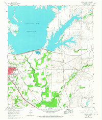
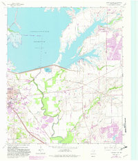
1960 Map of Lewisville East
USGS Topo · Published 1967About this map
The Garza-Little Elm Reservoir dominates this 1960s landscape, illustrating the mid-century transformation of the North Texas terrain through massive water management projects. Along the southern shore, the Lewisville Dam and its associated Control House and Lewisville Hatchery mark the intersection of industrial engineering and local recreation. The town of Lewisville is shown at a pivotal moment of growth, its street grid expanding near the junction of the Missouri Kansas Texas and the Gulf Colorado and Santa Fe railroads.
Find a feature on this map
48 named features on this map. Tap any name to fly to it.
Don’t see what you’re looking for? This feature index may not catch every label — zoom into the map to look around manually.
Map Details
Editions of this 1960 Lewisville East Map
5 editions found
Other maps of this area

1891 · Dallas
USGS Topo · 1:125,000

1893 · Dallas
USGS Topo · 1:125,000

1894 · Fort Worth
USGS Topo · 1:125,000

1925 · Mc Kinney 3-c
USGS Topo · 1:48,000

1925 · Dallas 2-b
USGS Topo · 1:48,000

1929 · Frisco
USGS Topo · 1:62,500

1931 · Carrollton
USGS Topo · 1:62,500

1931 · Grapevine
USGS Topo · 1:62,500

1954 · Dallas
USGS Topo · 1:250,000

1954 · Sherman
USGS Topo · 1:250,000