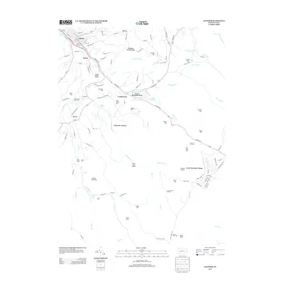
2013 Map of Ligonier
USGS Topo · Published 2013About this map
Fort Ligonier stands as a focal point in the northwest corner of this 2013 survey, anchoring the borough of Ligonier. The landscape transitions from the developed streets of the borough into the steep, wooded terrain of the Laurel Highlands. Significant industrial and recreational history is etched into the topography, with California Furnace and Rectors Mill marking early settlement patterns along the waterways, while the Laurel Mountain Ski Resort and Laurel Mountain Park represent the area's modern identity as a mountain destination.
Find a feature on this map
118 named features on this map. Tap any name to fly to it.
Don’t see what you’re looking for? This feature index may not catch every label — zoom into the map to look around manually.
Map Details
Editions of this 2013 Ligonier Map
This is the sole edition of this map. No revisions or reprints were ever made.
Other maps of this area

1900 · Latrobe
USGS Topo · 1:62,500

1902 · Latrobe
USGS Topo · 1:62,500

1903 · Latrobe
USGS Topo · 1:62,500

1913 · Somerset
USGS Topo · 1:62,500

1915 · Somerset
USGS Topo · 1:62,500

1920 · New Florence
USGS Topo · 1:62,500

1921 · New Florence
USGS Topo · 1:48,000

1922 · Donegal
USGS Topo · 1:62,500

1922 · New Florence
USGS Topo · 1:62,500

1935 · Donegal
USGS Topo · 1:62,500
Featured Places
- Laurel Mountain Village, Jenner Township
- Jenner Township, PA
- Laurel Mountain Park, PA
- California Furnace, Ligonier Township
- Laughlintown, Ligonier Township