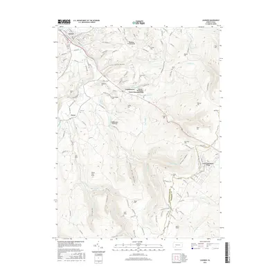
2016 Map of Ligonier
USGS Topo · Published 2016About this map
Loyalhanna Creek winds through the northwest corner of this Westmoreland County landscape, anchoring the borough of Ligonier. The map documents a rugged transition from the valley floor to the high ridges of Laurel Mountain, where the Laurel Mountain Park and Laurel Mountain Village sit along the boundary with Somerset County. The terrain is defined by numerous water features and hollows, including Lettie Shaffer Hollow and Silver Mine Hollow, as well as several reservoirs like the Ligonier Township Reservoir. Local history is preserved in the location of several family and community burial grounds, such as Valley Cem and Penrod Cem. The map also captures former industrial footprints at California Furnace and significant geological landmarks like Wolf Rocks and Ninety Foot Rocks.
Find a feature on this map
125 named features on this map. Tap any name to fly to it.
Don’t see what you’re looking for? This feature index may not catch every label — zoom into the map to look around manually.
Map Details
Editions of this 2016 Ligonier Map
This is the sole edition of this map. No revisions or reprints were ever made.
Other maps of this area

1900 · Latrobe
USGS Topo · 1:62,500

1902 · Latrobe
USGS Topo · 1:62,500

1903 · Latrobe
USGS Topo · 1:62,500

1913 · Somerset
USGS Topo · 1:62,500

1915 · Somerset
USGS Topo · 1:62,500

1920 · New Florence
USGS Topo · 1:62,500

1921 · New Florence
USGS Topo · 1:48,000

1922 · Donegal
USGS Topo · 1:62,500

1922 · New Florence
USGS Topo · 1:62,500

1935 · Donegal
USGS Topo · 1:62,500
Featured Places
- Laurel Mountain Village, Jenner Township
- Jenner Township, PA
- Laurel Mountain Park, PA
- California Furnace, Ligonier Township
- Laughlintown, Ligonier Township