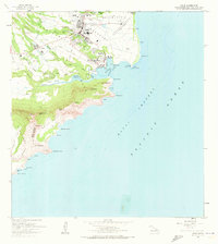
1963 Map of Lihue
USGS Topo · Published 1973About this map
The coastal commerce and rugged interior of Kauai converge at Lihue, the island's administrative center, as shown in this 1960s-era topographic study. The landscape is defined by the sharp transition from the bustling Nawiliwili Bay and its associated maritime infrastructure, such as the Nawiliwili Light Station, to the dramatic peaks of the Kipu region. Cultural and historical landmarks like the ancient Menehune Fishpond and the Immaculate Conception Sch illustrate the deep layers of human habitation here.
Find a feature on this map
62 named features on this map. Tap any name to fly to it.
Don’t see what you’re looking for? This feature index may not catch every label — zoom into the map to look around manually.
Map Details
Editions of this 1963 Lihue Map
2 editions found
Other maps of this area

1954 · Kauai
USGS Topo · 1:250,000

1963 · Lihue
USGS Topo · 1:24,000

1963 · Kapaa
USGS Topo · 1:24,000

1963 · Koloa
USGS Topo · 1:24,000

1965 · Waialeale
USGS Topo · 1:24,000

1967 · Kauai
USGS Topo · 1:250,000

1970 · Kauai
USGS Topo · 1:250,000

1978 · Kapaa
USGS Topo · 1:24,000
1978 · Lihue
USGS Topo · 1:24,000
1978 · Koloa
USGS Topo · 1:24,000