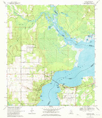
1970 Map of Lillian
USGS Topo · Published 1971About this map
The Perdido River and Perdido Bay form the central axis of this coastal landscape, serving as the physical border between Alabama and Florida. On the western shore, the town of Lillian is a primary hub, characterized by St Josephs Ch and the strategic Lillian Bridge crossing. The area's deep history is evidenced by the Indian Mound near Reeder Lake and the Old Spanish Cem along Scenic Drive.
Find a feature on this map
49 named features on this map. Tap any name to fly to it.
Don’t see what you’re looking for? This feature index may not catch every label — zoom into the map to look around manually.
Map Details
Editions of this 1970 Lillian Map
4 editions found
Other maps of this area

1920 · Robertsdale
USGS Topo · 1:62,500

1921 · Bon Secour
USGS Topo · 1:62,500

1921 · Fort Barrancas
USGS Topo · 1:62,500

1921 · Muscogee
USGS Topo · 1:62,500

1941 · Fort Barrancas
USGS Topo · 1:62,500

1941 · Muscogee
USGS Topo · 1:62,500

1941 · Robertsdale
USGS Topo · 1:62,500

1941 · Foley
USGS Topo · 1:62,500

1943 · Robertsdale
USGS Topo · 1:62,500

1943 · Muscogee
USGS Topo · 1:62,500