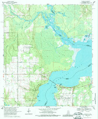
1970 Map of Lillian
USGS Topo · Published 1986About this map
Lillian sits at the western terminus of the Lillian Bridge, marking the border crossing between Alabama and Florida as it appeared in 1970. This coastal landscape is dominated by the wide expanse of Perdido Bay and the winding course of the Perdido River, which separates Baldwin and Escambia counties. The map captures a mix of maritime aviation history and deep-rooted local heritage, showing the U S Naval Reservation Bronson Field with its Seaplane Ramps alongside the Old Spanish Cem and a documented Indian Mound near Reeder Lake. Residential pockets like Perdido Heights and Paradise Beach dot the shoreline, while the interior remains a complex network of wetlands such as Juniper Swamp and Helton Bay. Numerous Claypit labels indicate local resource extraction within the pine-flats terrain.
Find a feature on this map
45 named features on this map. Tap any name to fly to it.
Don’t see what you’re looking for? This feature index may not catch every label — zoom into the map to look around manually.
Map Details
Editions of this 1970 Lillian Map
4 editions found
Other maps of this area

1920 · Robertsdale
USGS Topo · 1:62,500

1921 · Bon Secour
USGS Topo · 1:62,500

1921 · Fort Barrancas
USGS Topo · 1:62,500

1921 · Muscogee
USGS Topo · 1:62,500

1941 · Fort Barrancas
USGS Topo · 1:62,500

1941 · Muscogee
USGS Topo · 1:62,500

1941 · Robertsdale
USGS Topo · 1:62,500

1941 · Foley
USGS Topo · 1:62,500

1943 · Robertsdale
USGS Topo · 1:62,500

1943 · Muscogee
USGS Topo · 1:62,500